Category:Anneville (Ulvenhout)
Jump to navigation
Jump to search
| Object location | | View all coordinates using: OpenStreetMap |
|---|
Nederlands: Afbeeldingen van het landgoed Anneville (Ulvenhout), Annevillelaan 101, 4858 RA Ulvenhout. Gelegen nabij het buurtschap Geersbroek en Ulvenhout behorende tot de gemeente Breda en een klein deel tot Alpen-Chaam in de provincie Noord-Brabant in het zuiden van Nederland. Het landhuis is een rijksmonument. Annaville is ook nabij de A58. (https://erfgoed.breda.nl/erfgoed/archief/ulvenhout-residentie-koninklijke-familie) (https://erfgoed.breda.nl/erfgoed/archief/geersbroek-gehucht)
|
This is a category about rijksmonumentcomplex number 529510
|
| NO WIKIDATA ID FOUND! Search for Anneville (Ulvenhout) on Wikidata | |
| Upload media |
Subcategories
This category has the following 3 subcategories, out of 3 total.
Media in category "Anneville (Ulvenhout)"
The following 30 files are in this category, out of 30 total.
-
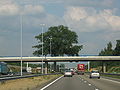 A58 Breda 2006 002.jpg 2,272 × 1,704; 1.35 MB
-
 Anneville (Ulvenhout) DSCF8498.jpg 2,816 × 2,112; 2.44 MB
-
 Anneville (Ulvenhout) DSCF8502.JPG 2,816 × 2,112; 2.95 MB
-
 Anneville (Ulvenhout) DSCF8504.JPG 2,816 × 2,112; 2.91 MB
-
 Anneville (Ulvenhout) DSCF8505.JPG 2,816 × 2,112; 2.35 MB
-
 Anneville (Ulvenhout) DSCF8506.JPG 2,816 × 2,112; 2.84 MB
-
 Anneville (Ulvenhout) DSCF8508.JPG 2,816 × 2,112; 2.55 MB
-
 Anneville (Ulvenhout) DSCF8509.JPG 2,816 × 2,112; 2.53 MB
-
 Anneville (Ulvenhout) DSCF8510.JPG 2,816 × 2,112; 2.81 MB
-
 Anneville (Ulvenhout) DSCF8519.JPG 2,816 × 2,112; 2.79 MB
-
 Anneville (Ulvenhout) DSCF8520.JPG 2,816 × 2,112; 2.81 MB
-
 Boerderij - Ulvenhout - 20211518 - RCE.jpg 1,200 × 815; 290 KB
-
 Boerderij met bakhuis - Ulvenhout - 20211517 - RCE.jpg 1,200 × 810; 227 KB
-
 Bomen landgoed Anneville DSCF8501.JPG 2,816 × 2,112; 2.93 MB
-
 Hazelaar met hazelnoot DSCF8528.JPG 2,816 × 2,112; 2.59 MB
-
 Informatiebord landgoed Anneville DSCF8527.JPG 2,816 × 2,112; 2.75 MB
-
 Informatiebord landgoed Anneville DSCF8532.JPG 2,816 × 2,112; 2.67 MB
-
 Koe landgoed Anneville DSCF8525.JPG 2,816 × 2,112; 2.88 MB
-
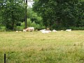 Koeien landgoed Anneville DSCF8521.JPG 2,816 × 2,112; 2.46 MB
-
 Koeien landgoed Anneville DSCF8522.JPG 2,816 × 2,112; 2.43 MB
-
 Koeien landgoed Anneville DSCF8523.JPG 2,816 × 2,112; 2.82 MB
-
 Koeien landgoed Anneville DSCF8524.JPG 2,816 × 2,112; 2.86 MB
-
 Plant ? DSCF8526.JPG 2,816 × 2,112; 2.52 MB
-
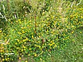 Plant ? DSCF8530.JPG 2,816 × 2,112; 2.34 MB
-
 Plant DSCF8500.JPG 2,816 × 2,112; 2.67 MB
-
 Portierswoning - Ulvenhout - 20211515 - RCE.jpg 1,200 × 811; 216 KB
-
 Stal - Ulvenhout - 20211516 - RCE.jpg 1,200 × 810; 258 KB
-
 Ulvenhout - Annevillelaan bij 101 - ingangshek moestuin.jpg 3,888 × 2,592; 7.85 MB
-
 Ulvenhout - Annevillelaan bij 101 - tuinsieraad.jpg 2,592 × 3,888; 7.23 MB
-
 Wegwijzers naar landgoed Anneville DSCF8531.JPG 2,816 × 2,112; 2.94 MB

_DSCF8498.jpg)
_DSCF8502.JPG)
_DSCF8504.JPG)
_DSCF8505.JPG)
_DSCF8506.JPG)
_DSCF8508.JPG)
_DSCF8509.JPG)
_DSCF8510.JPG)
_DSCF8519.JPG)
_DSCF8520.JPG)


